
|
HOME / PRODUCTS ABOUT US TOPOMORPHER MINERAL VENTURE DEEPEARTH PRICES HOW TO ORDER CONTACT US |
|
|


HawkEye Wizard is the most innovative geology software for teaching Earth Sciences. It offers interactive,
stereoscopic 3D (S3D) explorations
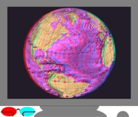
using real data from the Earth and Mars.
No other method of observation, either the shaded relief imagery and aerial photos freely available on the
Web or textbook drawings, offers such a unique and powerful educational tool:
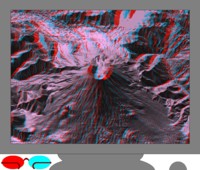
through stereoscopy, geology literally pops out of the screen!
The Earth and Beyond in Virtual Reality
With HawkEye Wizard, your
stereoscopic 3D
(S3D) voyage of discovery begins with a simple click of the mouse. Put the
anaglyph glasses
on and you are on your way to view the Earth and Mars in stereoscopy! HawkEye Wizard offers
guided audio tours
or
independent explorations,
from the seafloors to mountain peaks. Discover what
the latest advances in the Earth Sciences are all about:
plate tectonics
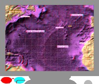
and evidence of plate tectonics like trenches, oceanic ridges, faulting, earthquakes, volcanism on the seabeds
and continents, or mountain building. See the aftermath of
landslides,
floods,
meteorite impacts,
ice ages,
erosion,
sedimentation,
the potential consequences of
global warming,
and much more and always in stereoscopy!
For a tour,
just listen to your guide who, through
animations,
and pop-up
"vignettes",
points to where to look and explains the significance of what is seen. You may even watch the simulation of
opening rifts. The
S3D cursor
now rolls up and down on the ground, sometimes beyond or in front of the screen.
You may move it while the guide is talking and check for yourself what is said: all the concepts
of modern geology become reality.
For independent explorations,
you may use the powerful tools for S3D observation.
It is easy to travel in any direction, zoom in on details or zoom out, modify the
relief enhancement
or the direction of
lighting,
tilt or pan around the view, measure elevations, etc...
You may overlay
contour lines
with adjustable units and intervals. You may select the
"glow"
or the
"laplacian"
mode to watch subdued features. The
"anamorphosis"
mode can be used to enhance details from a specific range of elevations. You may plot
hypsographs,
place
"banners",
polygons,
fences,
"dots",
measure
distances,
slopes, and
coordinates,
draw different
types of coordinate grids,
paint surfaces, visualize lines of
drainage,
overlay
maps, or satellite images, and adjust the sea level for
simulations.
With
stereoscopic picture pairs,
the
"telemetry"
mode allows the measurement of distances and dimensions; you may even use this powerful tool on the stereoscopic
pairs sent by the Martian Rovers and available for free on the internet!
Thanks to advances in digital processing, the "ghosts" that plagued anaglyphs are gone:
S3D images are superb!
HawkEye Wizard allows students to create customized
S3D "Scenes"
with banners and
audio.
A Scene can be saved on a floppy or a USB memory and submitted as an assignment.
HawkEye Wizard comes with a huge database: data sets of the entire Earth and Mars and large-scale data sets
from Arizona, California, Idaho, Louisiana, Montana, Oregon, Pennsylvania, Texas, Utah, Washington,
and Wyoming. HawkEye Wizard can
import data,
either
digital elevation models
(DEMs) or
mono
and
stereoscopic images.
All the large-scale USGS, GeoBase (Canada), etc... quadrangles can be
downloaded from the internet for free and readily imported. Data can be imported from
many different formats:
DEM, SDTS, ArcInfo (Export Grid, ASCIIGRID, GRID FORMAT), geoTIFF, binary files, etc..., or sources such as
LIDAR
or
SLAR.
For Earth Science activities and projects, please
click here
to see suggestions for covering California Standards (PDF document).
Hawkeye Wizard does not require special equipment and runs on every PC. The common 1024x768 pixels resolution
with 24 or more bits per pixel is recommended. 800 Mb of disk space is needed. Projectors work well, allowing
large audiences to follow a tour.
Click here to order HawkEye Wizard!
Price
HawkEye Wizard:
1 Computer $ 455
HawkEye Wizard:
1 School Site License $ 1999
[Home / Products] [About Us] [DeepEarth] [Mineral Venture] [TopoMorpher] [How to Order] [Contact Us]
